Have you ever thought about the age of your city? Not the date when it was founded, but it’s actual buildings. Take Portland, for example (since I live here). When were Portland’s building built? Certainly there are no buildings dating back before there was a city here, but that still leaves quite the range. In fact, Portland’s buildings were built throughout the last 150 years. This article explores some of the patterns we see in the age of our buildings.
By neighborhood
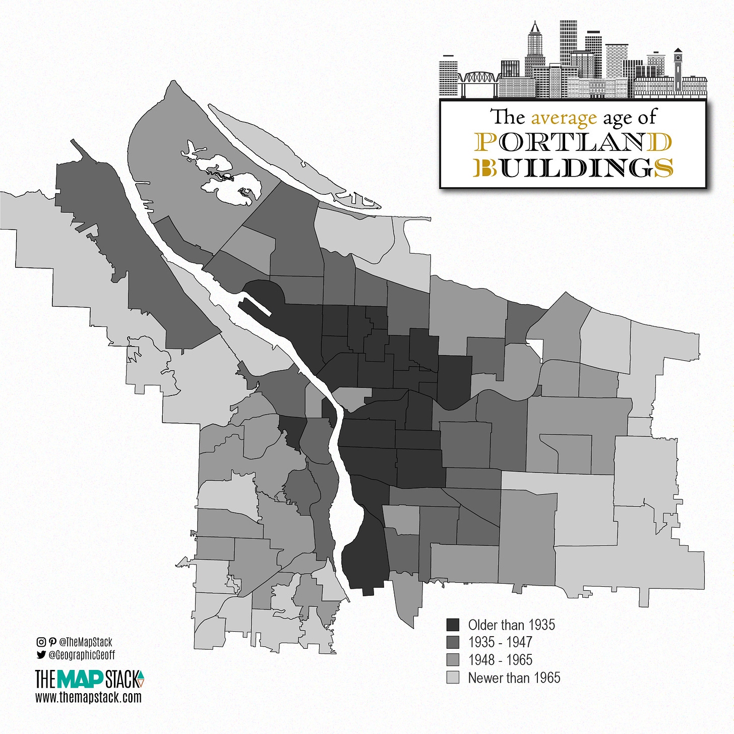
On a neighborhood level we can see Portland’s buildings were largely built as you would expect for any city. The inner core is considerably older than the outer rings. Old town, the small parcel hugging the river on the west side, lives up to its name! As you move outwards you can see how the city developed through time. As the city expanded, there was need to build more housing. It’s worth noting that the transportation form in those areas changes quite a bit too. Larger streets were built to facilitate automobiles in ways that the inner ring of Portland really wasn’t.
By hexagon
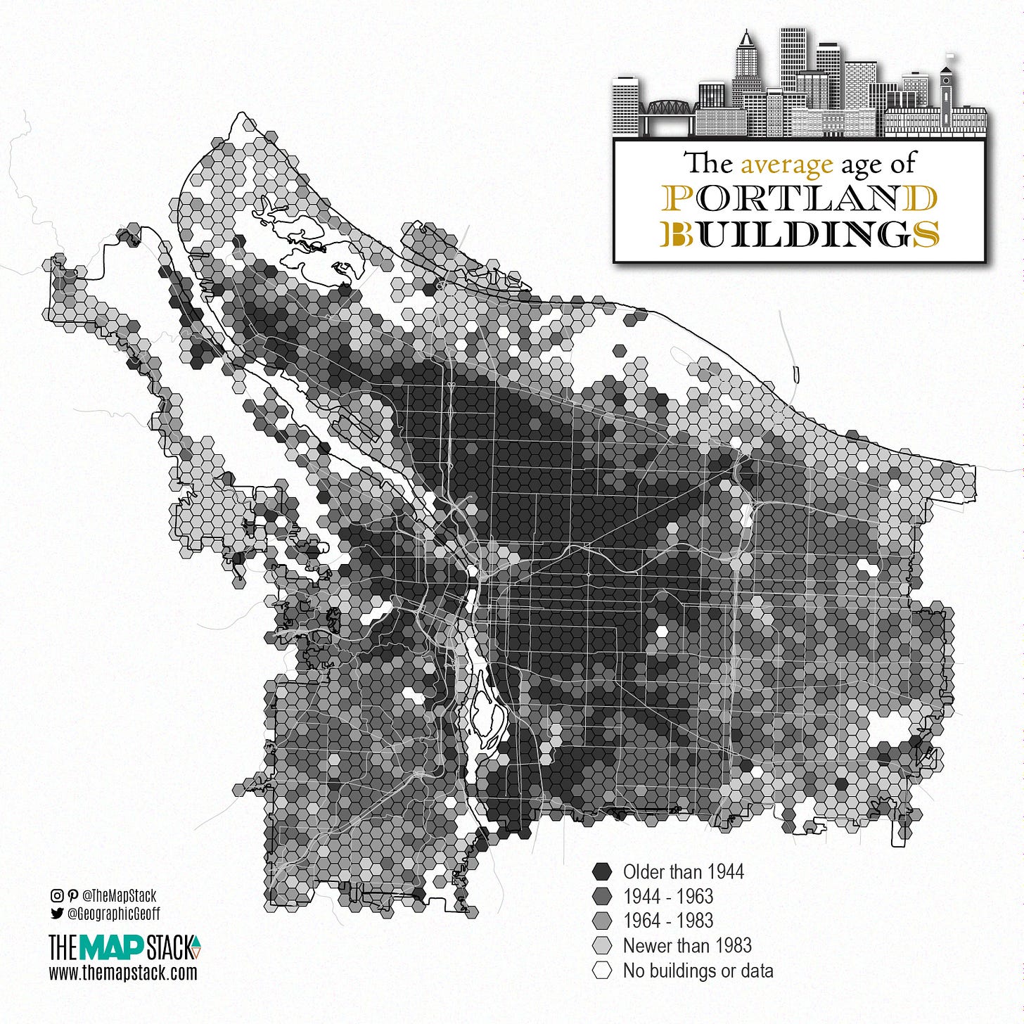
Looking at the neighborhoods doesn’t really tell the whole story though. To find more nuanced patterns, the data was joined to smaller hexagons that were created in ArcGIS. This enables a more complete story of where and when development happened. More recent developments that might not have changed whole neighborhood now show up. Here we can see the South Waterfront neighborhood light up just south of downtown. In the neighborhood map above it was showing as being within the 1935-1947 range, but now we see some hexagons that are showing as newer than 1983. Additionally, you can see where there are buildings that are quite old in those eastern and southwestern areas that were all coming up as fairly new neighborhoods.
Through time
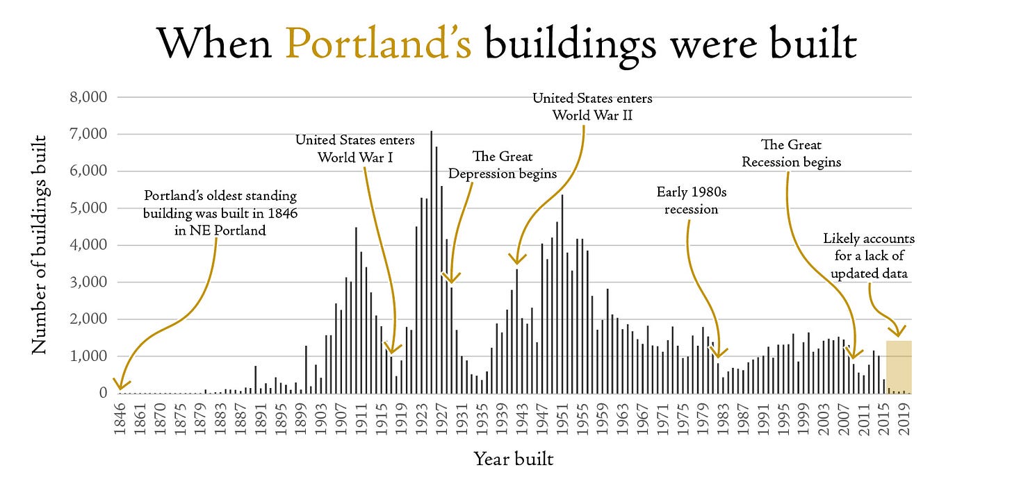
Of course, a map doesn’t show us the boom and bust cycles of construction. The graph above, however, gives a bit more context at the when and how much of it all. We can see the economic troughs followed by huge booms in construction. Most notably, however, we can see just how few homes were built after around 1955 as compared to the first half of the 20th century. Though it is worth noting here that these are individual buildings, not homes. So a single home that was built would count just as much as an apartment building with 200 units.
Still, given that Portland is still mostly single family housing, there’s been less construction over the last 50 years than would be expected. Of particular note, 2015 – 2020 there appears to be almost no new construction. I’m chalking this up to a lack of updated data, but I can’t be sure.
More housing needed
Not a big surprise to be ending on this note, but here we are. Portland needs more housing. I think it’s pretty plainly obvious that construction has not kept pace with the years of the past and our current homelessness issue illustrates that. And I don’t think Portland is unique in this situation either. In fact, I’ll be creating similar maps for additional cities over the coming weeks so stay tuned for those.


