Weekend Stack of Maps 6: Quantifying Happiness
Happiness, facial recognition, ye olde Europe, and a proper rail system for Oregon
Happy weekend! I’m delighted to report that Portland has returned to normal-ish temperatures. I think we’re still a little on the warm side, but at least I’ll be able to get some work done! Anyway, here are some of my favorite maps from the week.
Quantifying Happiness
I thought this was a really fun map. Visual Capitalist always created fun graphics, but this one I thought was paritcularly interesting because happiness is such an abstract concept. I’m surprised anyone can quantify it, let alone apply it spatially across the world.
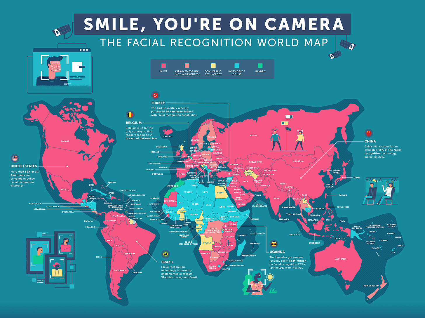
Smile! You’re On Camera
Did you know that facial recognition cameras are in use almost everywhere in the world. This is scary technology! Thankfully my own city of Portland, OR banned its use.
Ye Olde Europe
Just a classic map of Europe from the year of our lord 1444. Nothing otherwise special about it, but I enjoy looking at all the different kingdoms and countries from a time long ago. Germany sure is a hodgepodge.
An Actual Passenger Rail System
This is one of my maps. I’ve actually made a few for different states. My goal is to complete the wole continental U.S. state-by-state. Regardless, this is just a map showing how a regional rail system could work when combined with a high speed rail system. Regional feeds to the high speed. This is pretty much how Europe does it.
—
See you next week!


